Selected Publications

Large-scale mountains that affect civilized linguistic exchanges over space offer potentially profound cultural difference landscape implications. This article uses China’s national trunk mountain system as a natural experiment to explore the connection between spatial adjacency of mountains and cultural difference landscapes. Our spatial design documents that the presence of mountains widens the linguistic difference between two cities located on the opposite mountain sides, particularly when they are adjacent to administrative borders. The effect dwindles as spatial contiguity margins between city pairs increases. The results shed light on the importance of conceptualizing geographic contextual constraints to the configuration of cultural difference landscapes.
In Regional Studies, 2018.

Large-scale mountains that affect civilized linguistic exchanges over space offer potentially profound cultural difference landscape implications. This article uses China’s national trunk mountain system as a natural experiment to explore the connection between spatial adjacency of mountains and cultural difference landscapes. Our spatial design documents that the presence of mountains widens the linguistic difference between two cities located on the opposite mountain sides, particularly when they are adjacent to administrative borders. The effect dwindles as spatial contiguity margins between city pairs increases. The results shed light on the importance of conceptualizing geographic contextual constraints to the configuration of cultural difference landscapes.
In Annals of the American Association of Geographers, 2018.

Recent Publications

More Publications

. Intercomparison of Six Upscaling Evapotranspiration Methods: From Site to the Satellite Pixel. In Journal of Geophysical Research: Atmospheres, 2018.

PDF DOI

. Geographically Weighted Area-to-Point Regression Kriging for Spatial Downscaling in Remote Sensing. In Remote Sensing, 2018.

PDF DOI

. Downscaling AMSR-2 Soil Moisture Data With Geographically Weighted Area-to-Area Regression Kriging. In IEEE Transactions on Geoscience and Remote Sensing, 2018.

DOI

. Deriving temporally continuous soil moisture estimations at fine resolution by downscaling remotely sensed product. In International Journal of Applied Earth Observation and Geoinformation, 2018.

PDF DOI

Projects

SDG China

Sustainable Development Goals (SDG) in China: http://sdgcn.org/
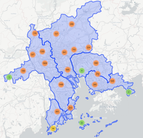
Land Parcel in PRD

We visualized the land transaction data in the Pearl River Delta in China, from year 2000 to 2017. There are totally 10,505 land parcels, which cover six cities: Guangzhou, Shenzhen, Dongguan, Foshan, Zhuhai, and Zhongshan.

China House Price Visualization

We adopte Mapbox studio to visualize the housing price in whole main China cities. See: http://jianghao.wang/HousePrice/ for details.
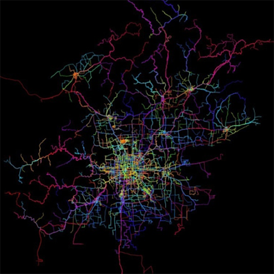
China Bus System

We visualize national wide prefecture-level cities bus system (exclude Taiwai province). There are totally 24,500 bus lines in China in year 2013.
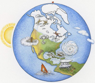
World Climate Data Visualization

WorldClim is a set of global climate layers (climate grids) with a spatial resolution of about 1 square kilometer. The data can be used for mapping and spatial modeling in a GIS or with other computer programs. Here, we want to visualize the WorldClim data to give research a direct reference.

Teaching

Teaching instructor at University of Chinese Academy of Sciences (UCAS):

  • Applications in Geographical Information Science – Urban Sensing and Computing
  • Geographical Information Science Tutorial and Practice
  • Modern Cartography – Web Cartography
  • Map Design and Making – Geo-spatial Big Data Mapping
    • 2016, undergraduates, 20–30 students, 3 class hours, Invited by Prof. Yingjie Wang

Invited teaching instructor:

  • Spatio-temporal Big Data Analysis and Visualization, Tsinghua University.
    • 2016, 2017, undergraduates, 100 students, 4 class hours, Invited by Prof. Ying Long

Recent Invited Talks

More Talks

Lessons from big data - what can Pedometrics learn
Jun 25, 2017
Pan-spatial Dynamic Urban Sensing
Jun 3, 2017
Urban Pulse: Pan-spatial Dynamic Urban Sensing at Fine Scale
May 26, 2017
Chinese Footprint and Mobility: New Evidence from Geospatial Big Data
Feb 24, 2017
Chinese Footprint and Mobility: New Evidence from Geospatial Big Data
Jan 17, 2017
Chinese Footprint and Mobility: New Evidence from Geospatial Big Data
Dec 1, 2016
Urban Spatio-temporal Data Analysis and Visualization
Nov 8, 2016

Recent Posts

More Posts

Table of Contents Configure Ubuntu install ubuntugis on Ubuntu install libxml2-dev and libcurl4-openssl-dev install FreeType Install Latest R Install R on Ubuntu 16.04 install R packages Update packages Configure R with Chinese Env. Use RStudio Server Install RStudio Server Use Rstudio server Creating RStudio User Using R Studio Server Configure Ubuntu install ubuntugis on Ubuntu ref: https://github.com/r-spatial/sf

CONTINUE READING

Table of Contents R Packages User defined Chinese R Packages R Markdown Custom Formats: https://blog.rstudio.org/2016/03/21/r-markdown-custom-formats/ tufte — Documents in the style of Edward Tufte rticles — Formats for creating LaTeX based journal articles rmdformats — Formats for creating HTML documents markdowntemplates: A collection of alternate R markdown templates https://github.com/hrbrmstr/markdowntemplates thesisdown: An updated R Markdown thesis template using the bookdown package https://github.

CONTINUE READING

Table of Contents Procedure Install zlib Adjust the environment Get new bzlib support Get liblzma Get pcre Get curl Get openssl Get readline Get R install hdf4 install hdf5 install gdal install libxml2 Install R packages Procedure Complile latest R in RedHat Linux (HPC) without root access. Main Ref: Thanks to PJ. Mostly Harmless’s blog: Building R-devel on RedHat Linux 6 Install zlib cd ~/src wget http://zlib.

CONTINUE READING

Contact

  • wangjh@lreis.ac.cn
  • 11A Datun Rd., Beijing, 100101, China
  • Friday 14:00 to 15:00 or email for appointment